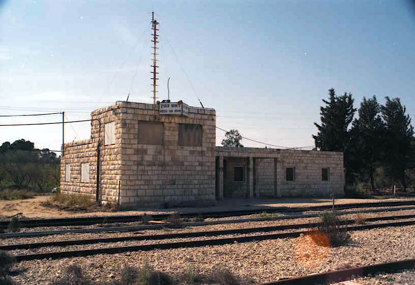
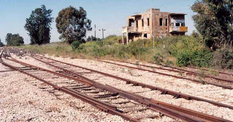
 We took off from Rosh Ha'Ayin in Israel. It is now the terminal for a suburban service from Tel Aviv but for many years it was a spooky place passed only by occasional freight trains.
 These pictures are from 1998. Click on the images to enlarge them.
Photos: Hans-Henrik Landsvig
A Trip to the Wild West Bank
By Sybil Ehrlich
On 22nd. June two intrepid Harakevet reporters went on a journey of discovery where few have gone before. Hans-Henrik Landsvig hired a car from an East Jerusalem outfit, with the hire firm's name in Arabic plastered all over it to be less conspicuous, (although he says that their cars are terrible and indeed the air-conditioning was practically non-existent), and we headed off into the wilds of Palestinian Autonomous Territory.
Our first stop was actually Rosh Ha' Ayin, where the tracks have been removed. The old station building is to be preserved, according to the workmen there. From there we drove in the direction of Nablus (Shechem).
We were stopped by a rather unfriendly Palestinian road-block, which insisted on searching the boot and our bags. (I didn't offer them the carrier bag containing a large selection of Hebrew maps and guidebooks - they didn't seem very interested in that!) Eventually they let us through and we continued into Nablus.
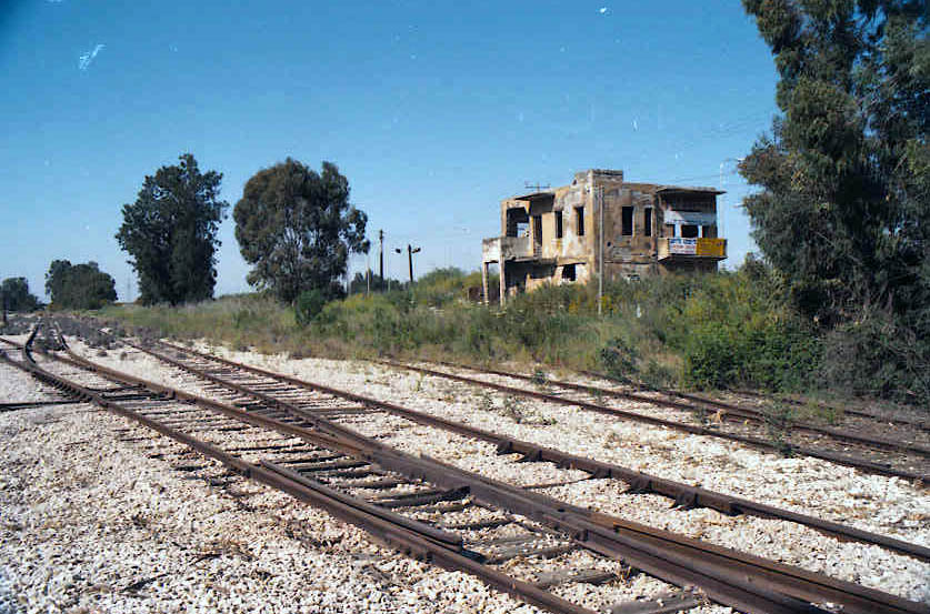
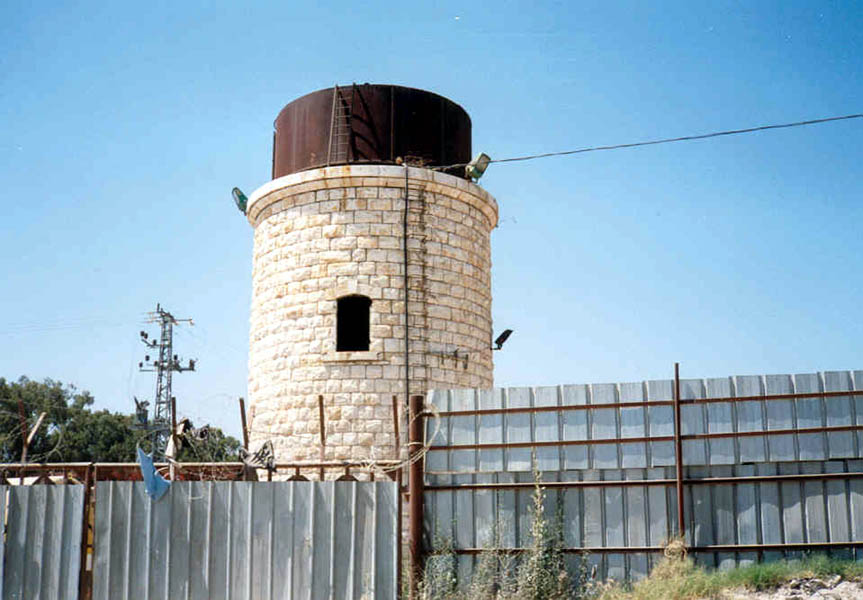
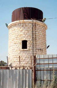
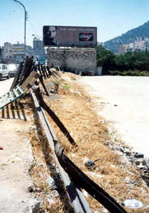 The remains of the Nablus water tower in 1999. Note the fence.
Photo: Sybil Ehrlich
I have a book with a fairly recent picture of the water tower, so we knew what to look for. We drove into the centre of town (actually a quite decent-looking sort of place, clean, well-ordered and with lots of new building going on) and I spotted the typical Turkish water tower. We drove around their one-way system (strictly observed - no cars rushing at each other in all directions and hooting) about five times looking for a parking space in the choked town centre, and ended up three yards from our tower.
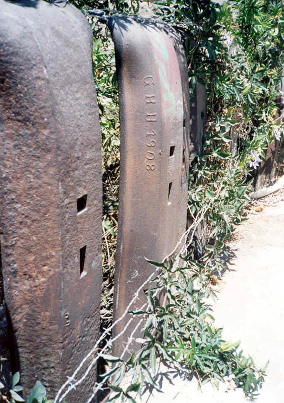
The tower is next to a large empty lot (why don't they use it as a car-park?), fenced off with real narrow-gauge rail (horizontal), some stamped' JJ 1908' (I didn't write down the exact wording - we were watched but not stopped, and I took photos, but I thought taking notes might be pushing it a bit), and vertical posts consisting of standard-gauge steel sleepers in vast quantities.
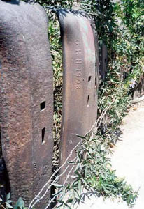
Detail of the fence. Could ğGHHĞ possibly stand for ğGutehoffnungshütteĞ? Other Sleepers were marked ğJJĞ possibly for ğJaffa-JerusalemĞ. Some pieces of rail had markings with Arabic letters. The Turks used Arabic letters until 1928.
Photo: Sybil Ehrlich
The empty lot might have been home to the station house; or perhaps that was one of the many old buildings with more recent additions. There was no point in asking - even without language difficulties nobody would know what we were talking about so many decades after the fact.
I also took the opportunity of going into the post office to ask about railways stamps - no, only birds and butterflies. Still, it was worth asking.
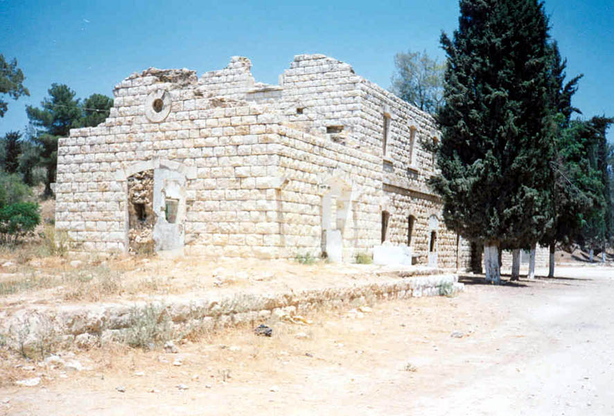
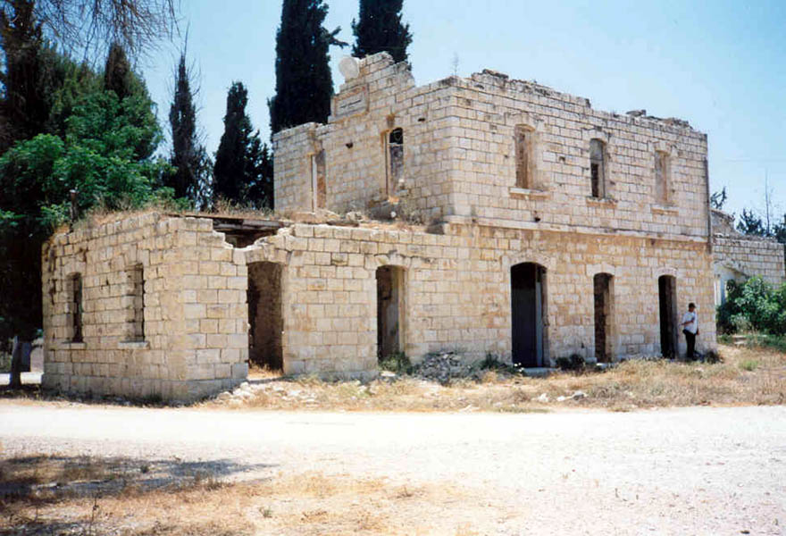
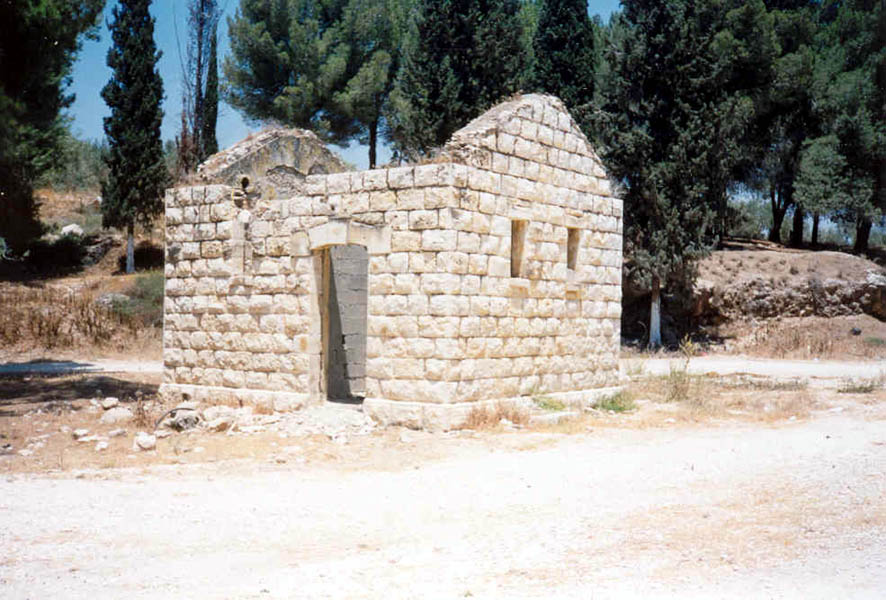
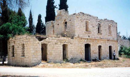
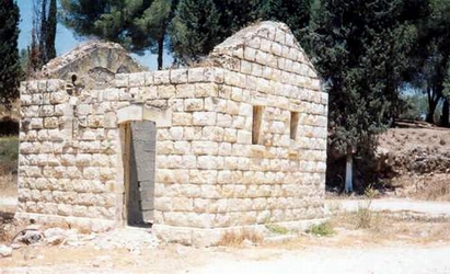
From there we decided to look for the station at Massudiye (popularly referred to as Sebastia, where the settlers stage occasional demonstrations.)
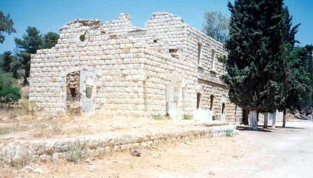 Massudiye 1999.
Photo: Sybil Ehrlich
Both Hans-Henrik and I are good map-readers, but something seemed strange. We spent about an hour climbing over Samarian hills (on foot, beautiful countryside) trying to foIlow the railway embankment, which just wasn't going in the right direction. The roads just weren't right. There was a stream, yes, but why was the settlement of Shavei Shomron on the wrong side of the road?
Massudiye 1999.
Photo: Sybil Ehrlich
Finally the penny dropped. There are new roads, the map (1:100,000, partially corrected to 1992) was simply out of date. We finally realised we were about three kilometres from where we should have been.
 Massudiye 1999.
Photo: Sybil Ehrlich
Eventually, out of curiosity, we took a side-road and saw a sign written only in Arabic (which neither of us can read), but with a picture of a locomotive. A few yards further on, and there was the station, with a restaurant just up the hill. Success!
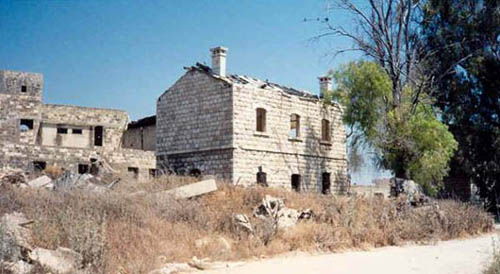
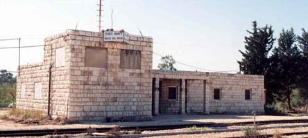
Tulkarm 1999.
Photo: Sybil Ehrlich
Next stop was Tulkarm, where the water tower (a thin circular one, same shape as Afula's) still has its tank, and there are three somewhat derelict buildings. The station is only a few metres from the Israeli roadblock.
 Tulkarm 1999.
Photo: Sybil Ehrlich
Text first published in Harakevet, Issue 46, September 1999.
Back to: Trains and Trams